






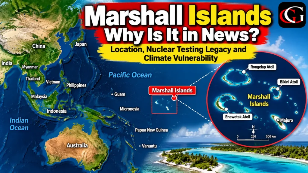
Why Is the Marshall Islands in News?
The Marshall Islands are in the news after a new UN human-rights report highlighted the continuing health, environmental and human-rights consequences of the United States’ nuclear testing programme in the country. The report, discussed before the UN Human Rights Council on 1 October 2026, called for further measures including healthcare support and greater access to historical records.
The issue remains significant because the United States conducted 67 nuclear weapons tests in the Marshall Islands between 1946 and 1958, mainly at Bikini and Enewetak Atolls.
About the Marshall Islands: Geographic Overview
- The Republic of the Marshall Islands (RMI) is an island country in Micronesia in the central North Pacific Ocean, roughly between Hawaii and the Philippines. It consists of 29 coral atolls containing around 1,225 individual islands.
- Unlike countries dominated by large continental landmasses, the Marshall Islands have a very small land area of about 181 square kilometres, while their maritime territory is enormous. The islands are generally low-lying coral formations, making them particularly sensitive to environmental changes and sea-level rise.
- The capital, Majuro, is located on Majuro Atoll and serves as the country’s principal administrative and economic centre.
Bikini and Enewetak Atolls
Two locations are particularly important in understanding the country’s geography and history. Bikini Atoll became the site of numerous U.S. nuclear tests, including the 1954 Castle Bravo thermonuclear test. Enewetak Atoll was also extensively used for nuclear testing. The U.S. Department of Energy continues medical and environmental monitoring programmes in nuclear-affected atolls including Bikini, Enewetak, Rongelap and Utrik
The Runit Dome, located on Runit Island in Enewetak Atoll, contains radioactive waste associated with the nuclear-testing era. Its condition has also attracted attention because climate change and rising sea levels create additional concerns for low-lying island infrastructure.
Geographic Significance
1. A Unique Atoll Geography
The Marshall Islands demonstrate how coral atolls form distinctive human and physical landscapes. Their narrow strips of land, lagoons and surrounding ocean make land and freshwater resources especially important.
2. Nuclear Testing and Environmental Geography
The Marshall Islands are an important example of how human activities can create long-lasting environmental impacts. Nuclear testing altered land-use patterns, displaced communities and created continuing monitoring and remediation requirements.
3. Climate Vulnerability
The country’s low elevation makes the Marshall Islands an important case study in sea-level rise, coastal vulnerability and climate adaptation. The U.S. Department of Energy specifically recognises climate-change concerns associated with the Runit Dome and other environmental hazards.
4. Strategic Pacific Geography
The islands occupy a strategically significant position in the central Pacific, between major Pacific territories and sea routes. Their geography has therefore been important both historically and in contemporary Pacific affairs.
Frequently Asked Questions
1. Where are the Marshall Islands located?
They are located in Micronesia in the central North Pacific Ocean, between Hawaii and the Philippines.
2. Why are Bikini and Enewetak Atolls famous?
They were major sites of the 67 U.S. nuclear tests conducted in the Marshall Islands between 1946 and 1958.
3. Why are the Marshall Islands vulnerable to climate change?
The country consists primarily of low-lying coral atolls, with very limited land area and extensive exposure to the surrounding ocean, making coastal and sea-level changes particularly important.


