






Why Is It in News?
The park has recently highlighted the hazards of summer monsoon storms and flash floods, which can rapidly affect Zion Canyon and The Narrows. NPS notes that storms can develop upstream and send floodwater into narrow canyons even when conditions appear calm locally
These developments provide a useful entry point to understand the physical geography, geology and river processes that created Zion’s spectacular landscape.
About Zion National Park: Geographic Overview
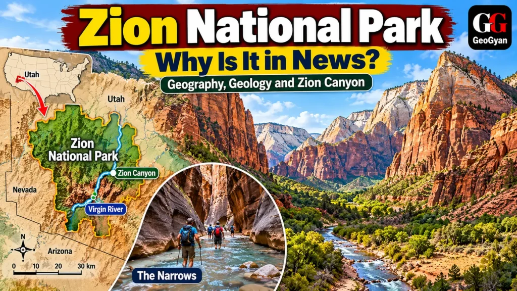
Zion National Park is located in southwestern Utah, USA, mainly within Washington, Iron and Kane counties. It lies along the western edge of the Colorado Plateau, close to the transition with the Mojave Desert and Basin and Range region
Established as a national park in 1919, Zion covers roughly 232 square miles (about 600 km²). Its landscape includes high plateaus, mesas, sandstone cliffs, narrow canyons, hanging valleys and natural arches. Elevation ranges from about 1,128 m (3,700 ft) to 2,660 m (8,726 ft) at Horse Ranch Mountain.
The most famous landscape feature is Zion Canyon, which has been deeply cut by the North Fork of the Virgin River. The canyon contains spectacular exposures of Navajo Sandstone, locally reaching around 2,000 feet in thickness.
How Was Zion Canyon Formed?
Zion’s landscape records hundreds of millions of years of geological history. Ancient environments ranging from shallow seas and coastal plains to extensive deserts deposited layers of sediment that later became sedimentary rocks.
Subsequent uplift of the Colorado Plateau increased the gradient of streams. The Virgin River then gained greater erosive power and progressively cut downward through the sandstone and other sedimentary layers. The result is the spectacular system of deep, narrow canyons and cliffs visible today.
One of the best examples is The Narrows, the narrowest section of Zion Canyon. In places, the canyon walls rise roughly 1,000–2,000 feet while the river channel can narrow to only 20–30 feet.
Geographic Significance
1. A Classic Example of Fluvial Erosion
The Virgin River is the principal geomorphic agent shaping Zion. It drops roughly 7,800 feet over its 160-mile course, giving it considerable erosive power
2. Importance of Sandstone Geomorphology
Zion provides an excellent field example of how differential erosion, jointing, weathering and river incision produce cliffs, mesas, arches, slot canyons and other landforms.
3. Flash-Flood Geography
Zion demonstrates how rainfall far upstream can rapidly generate dangerous floods in narrow desert canyons. During the Southwest monsoon season, intense rainfall can funnel water, sediment and debris into Zion’s drainage system
4. Ecological Diversity
Large differences in elevation create several ecological zones, ranging from desert and semi-desert vegetation to pinyon-juniper woodland and higher-elevation conifer communities.
Sources: NPS,
Frequently Asked Questions
1. Where is Zion National Park located?
Zion National Park is in southwestern Utah, USA, on the western edge of the Colorado Plateau.
2. What river formed Zion Canyon?
The Virgin River, particularly its North Fork, is the primary river responsible for carving and continuing to shape Zion Canyon.
3. Why is Zion National Park geographically important?
Zion is an excellent example of fluvial erosion, sandstone landscapes, canyon formation, plateau uplift, desert geomorphology and ecological variation with elevation.