


Access the latest NCERT Solutions for Class 9 Geography Chapter-3: Drainage, updated for 2024-2025. Solution is designed to help students tackle difficult questions with ease. The content is written in simple, easy-to-understand language.
Exercise
Choose the right answer from the four alternatives given below.
(i) In which of the following states is the Wular lake located?
(a) Rajasthan
(b) Uttar Pradesh
(c) Punjab
(d) Jammu and Kashmir
Ans. (d) Jammu and Kashmir
(ii) The river Narmada has its source at
(a) Satpura
(b) Amarkantak
(c) Brahmagiri
(d) Slopes of the Western Ghats
Ans. (b) Amarkantak
(iii) Which one of the following lakes is a saltwater lake?
(a) Sambhar
(b) Dal
(c) Wular
(d) Gobind Sagar
Ans. (a) Sambhar
(iv) Which one of the following is the longest river of Peninsular India?
(a) Narmada
(b) Godavari
(c) Krishna
(d) Mahanadi
Ans. (b) Godavari
(v) Which one among the following rivers flows through a rift valley?
(a) Mahanadi
(b) Krishna
(b) Tungabhadra
(d) Tapi
Ans. (d) Tapi
Answer the following questions briefly.
(i) What is meant by a water divide? Give an example.
A water divide is a geographical feature such as a mountain or an upland that separates two drainage basins. For example, the Western Ghats act as a water divide between rivers draining into the Arabian Sea and those flowing into the Bay of Bengal.
(ii) Which is the largest river basin in India?
The Ganga River Basin is the largest river basin in India.
(iii) Where do the rivers Indus and Ganga have their origin?
The Indus River originates near Lake Mansarovar in Tibet. The Ganga River originates from the Gangotri Glacier in Uttarakhand, where its headstream is called Bhagirathi.
(iv) Name the two headstreams of the Ganga. Where do they meet to form the Ganga?
The two headstreams of the Ganga are the Bhagirathi and the Alaknanda. They meet at Devprayag in Uttarakhand to form the Ganga.
(v) Why does the Brahmaputra in its Tibetan part have less silt, despite a longer course?
In its Tibetan part, the Brahmaputra River flows through a cold and dry region, which results in less erosion and therefore less silt.
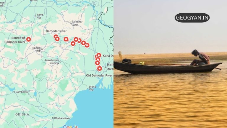
(vi) Which two Peninsular rivers flow through troughs?
The two Peninsular rivers that flow through troughs are the Narmada and the Tapi.
(vii) State some economic benefits of rivers and lakes.
Rivers and lakes provide water for irrigation, drinking, and industrial use. They also support fishing, enable hydropower generation, help in transportation, and boost tourism.
3. Group the following lakes under two categories: natural and created by human beings.
Natural lakes:
(a) Wular, (b) Dal, (c) Nainital, (d) Bhimtal, (f) Loktak, (g) Barapani, (h) Chilika, (i) Sambhar, (j) Pulicat
Artificial lakes (created by human beings):
(e) Gobind Sagar, (j) Rana Pratap Sagar, (k) Nizam Sagar, (m) Nagarjuna Sagar, (n) Hirakund
4. Discuss the significant difference between the Himalayan and the Peninsular rivers.
Himalayan Rivers are perennial, meaning they have water throughout the year, as they are fed by both rain and glacier melt. They have long courses, carry large amounts of silt, and form well developed deltas.
Peninsular Rivers are seasonal, depending mainly on monsoon rains. They have shorter, shallower courses and flow through rocky terrain, often forming estuaries.
5. Compare the east flowing and the west flowing rivers of the Peninsular plateau.
- East Flowing rivers: Rivers like the Godavari, Krishna, and Kaveri flow eastwards and drain into the Bay of Bengal. They form extensive deltas.
- West Flowing rivers: Rivers like the Narmada and Tapi flow westwards and drain into the Arabian Sea. They form estuaries instead of deltas.
6. Why are rivers important for the country’s economy?
Rivers are crucial for irrigation, especially in a predominantly agrarian country like India. They also support drinking water supply, hydroelectric power generation, transportation, fisheries, and tourism, contributing significantly to the overall economy. Rivers also help in maintaining ecosystems and enhancing natural beauty.
Other Important Short Answer Type Questions
Here are important short answer type questions and answers based on Chapter 3 of the NCERT Class 9 Geography book, “Drainage.” These questions are framed based on topics frequently asked in NCERT Class 9 exams and UPSC.
1. What is a drainage basin?
A drainage basin is an area drained by a single river system, where all the water converges to a common outlet such as a sea, lake, or ocean.
2. What is a water divide? Give an example.
A water divide is an elevated area, such as a mountain or upland, that separates two drainage basins. An example is the Ambala, which divides the Indus and the Ganga river systems.
3. Why are the Himalayan rivers perennial?
The Himalayan rivers are perennial because they receive water from both rainfall and melting snow from the mountains. This ensures that they have water throughout the year.
4. Explain the difference between Himalayan and Peninsular rivers.
Himalayan rivers are long, perennial, and have large basins, whereas Peninsular rivers are shorter, seasonal, and depend on monsoon rains for water.
5. What are oxbow lakes, and how are they formed?
Oxbow lakes are U Shaped water bodies formed when a river’s meander is cut off from the main flow due to sediment deposition, isolating the curve.
6. What is the significance of rivers for India’s economy?
Rivers are vital for irrigation, agriculture, hydroelectric power generation, transportation, and providing freshwater for industrial and domestic uses. They also support fisheries and promote tourism.
7. Name the major tributaries of the Ganga river.
The major tributaries of the Ganga include the Yamuna, Ghaghara, Gandak, Kosi (from the Himalayas), and Chambal, Betwa, and Son (from the Peninsular uplands).
8. What are the major features of the Brahmaputra river system?
The Brahmaputra originates in Tibet, where it is known as Tsangpo. It enters India in Arunachal Pradesh and flows through Assam with a braided channel. The river causes significant flooding in the rainy season and forms the world’s largest riverine island, Majuli.
9. What are the characteristics of the Sundarban Delta?
The Sundarban Delta, formed by the Ganga and Brahmaputra, is the world’s largest and fastest growing delta. It is named after the Sundari trees that thrive in the area and is home to the Royal Bengal tiger.
10. How is a rift valley formed? Name two rivers that flow through rift valleys.
A rift valley is formed when a block of land between two faults sinks. The Narmada and Tapi rivers flow through such rift valleys.
11. Why do Peninsular rivers form deltas at their mouths?
Peninsular rivers such as the Godavari, Mahanadi, Krishna, and Kaveri form deltas because they carry large amounts of sediment, which they deposit at their mouths as they enter the Bay of Bengal.
12. Why do the Peninsular rivers have shorter courses compared to Himalayan rivers?
Peninsular rivers originate in the highlands and plateaus of the Peninsular region, which is geologically older and more stable. As a result, these rivers have shorter, less steep courses.
13. What is an estuary? Which Indian rivers form estuaries?
An estuary is a partially enclosed coastal body of water where freshwater from rivers mixes with seawater. The Narmada and Tapi rivers form estuaries as they flow into the Arabian Sea.
14. Name the freshwater lakes in India.
Some important freshwater lakes in India include Wular Lake in Jammu and Kashmir (the largest), Dal Lake, Bhimtal, Nainital, and Loktak Lake.
15. How does the Namami Gange Programme aim to clean the Ganga river?
The Namami Gange Programme, initiated in 2014, aims to reduce pollution and conserve the Ganga by implementing pollution abatement projects and promoting river rejuvenation through effective waste management and public awareness campaigns.
16. What are lagoons? Name two lagoons in India.
Lagoons are shallow bodies of water separated from a larger water body by a sandbar or coral reef. Two major lagoons in India are Chilika Lake in Odisha and Pulicat Lake in Tamil Nadu.
17. What is the importance of lakes?
Lakes help regulate river flow, prevent floods, and store water during dry seasons. They support tourism, moderate local climates, and serve as reservoirs for hydropower projects.
18. What causes river pollution in India?
River pollution in India is caused by untreated sewage, industrial waste, agricultural runoff, and increasing urbanization, which lead to reduced water quality and the loss of aquatic life.
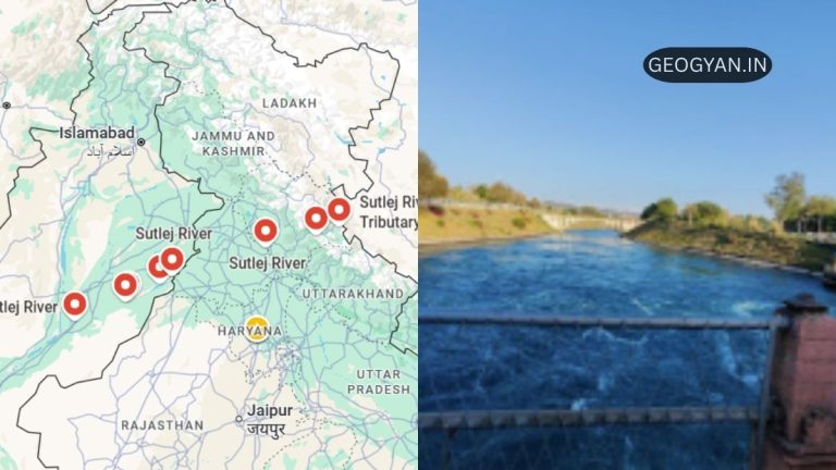
19. Explain the significance of the Indus Water Treaty.
The Indus Water Treaty (1960) between India and Pakistan allows India to use only 20% of the water from the Indus river system for irrigation purposes in Punjab, Haryana, and parts of Rajasthan.
20. What are braided rivers? Give an example.
Braided rivers have multiple channels that intertwine due to heavy sediment load and fluctuating water flow. The Brahmaputra River in Assam is an example of a braided river.
MCQs: Drainage
Here are 20 multiple choice questions (MCQs) based on Chapter 3 of the NCERT Class 9 Geography book “Drainage,” aligned with previous years’ NCERT 9th class exams and UPSC.
1. What is the area drained by a single river system called?
(a) Watershed
(b) Water divide
(c) Drainage basin
(d) River valley
2. Which of the following rivers is a Himalayan river?
(a) Narmada
(b) Godavari
(c) Ganga
(d) Kaveri
3. What is a water divide?
(a) An area where two rivers meet
(b) Elevated area separating two drainage basins
(c) A region where two rivers merge into one
(d) A lake formed by river action
4. The largest river basin in India is of which river?
(a) Yamuna
(b) Godavari
(c) Indus
(d) Ganga
5. Which of the following rivers forms the largest delta in the world?
(a) Godavari
(b) Ganga Brahmaputra
(c) Narmada
(d) Krishna
6. The Indus Water Treaty allows India to use what percentage of Indus water?
(a) 10%
(b) 20%
(c) 30%
(d) 50%
7. The Yamuna river originates from which glacier?
(a) Gangotri
(b) Yamunotri
(c) Siachen
(d) Pindari
8. The river Brahmaputra is known as what in Tibet?
(a) Jamuna
(b) Tsangpo
(c) Dihang
(d) Lohit
9. Which river in India flows through a rift valley?
(a) Godavari
(b) Kaveri
(c) Narmada
(d) Brahmaputra
10. The source of the river Narmada is located at:
(a) Amarkantak
(b) Satpura range
(c) Brahmagiri hills
(d) Himalayas
11. Which river is known as the “Dakshin Ganga”?
(a) Krishna
(b) Godavari
(c) Kaveri
(d) Mahanadi
12. Which river forms the second largest waterfall in India, the Shivasamudram Falls?
(a) Godavari
(b) Krishna
(c) Kaveri
(d) Narmada
13. Which of the following lakes is the largest saltwater lake in India?
(a) Wular
(b) Dal
(c) Sambhar
(d) Pulicat
14. The largest freshwater lake in India is:
(a) Wular
(b) Chilika
(c) Loktak
(d) Dal
15. The river Mahanadi originates from which state?
(a) Odisha
(b) Maharashtra
(c) Chhattisgarh
(d) Madhya Pradesh
16. Which of the following is a tributary of the Ganga from the Peninsular uplands?
(a) Yamuna
(b) Chambal
(c) Gandak
(d) Kosi
17. Which of the following rivers flows into the Arabian Sea?
(a) Ganga
(b) Narmada
(c) Krishna
(d) Brahmaputra
18. The Brahmaputra river causes severe flooding in which state of India?
(a) Uttar Pradesh
(b) Assam
(c) West Bengal
(d) Arunachal Pradesh
19. Which river forms the Sundarban Delta?
(a) Indus
(b) Ganga Brahmaputra
(c) Krishna
(d) Kaveri
20. The Krishna river originates from:
(a) Mahabaleshwar
(b) Nasik
(c) Satpura
(d) Brahmagiri
Answers:
1. (c) Drainage basin
2. (c) Ganga
3. (b) Elevated area separating two drainage basins
4. (d) Ganga
5. (b) Ganga Brahmaputra
6. (b) 20%
7. (b) Yamunotri
8. (b) Tsangpo
9. (c) Narmada
10. (a) Amarkantak
11. (b) Godavari
12. (c) Kaveri
13. (c) Sambhar
14. (a) Wular
15. (c) Chhattisgarh
16. (b) Chambal
17. (b) Narmada
18. (b) Assam
19. (b) Ganga Brahmaputra
20. (a) Mahabaleshwar
Other Chapter
| Chapter 1: INDIA – SIZE AND LOCATION | Chapter 2:- PHYSICAL FEATURES OF INDIA |
| Chapter 4:- CLIMATE | Chapter 5:- NATURAL VEGETATION AND WILDLIFE |
| Chapter 6:- POPULATION |


