


Estimated reading time: 4 minutes
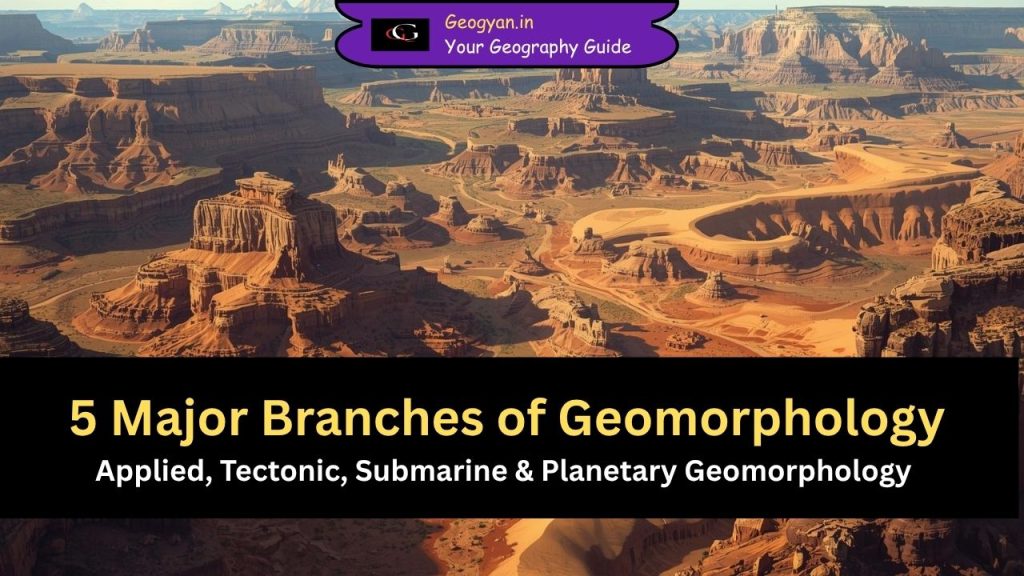
Table of contents
- Applied Geomorphology: How Does Geomorphology Help Solve Real Problems?
- Tectonic Geomorphology: How Do Tectonics Shape Landscapes?
- Submarine Geomorphology: How Is the Ocean Floor Shaped?
- Planetary Geomorphology: Can We Study Landforms on Other Planets?
- Climatic Geomorphology: Do Climatic Zones Create Distinct Landforms?
- FAQs
- Also Read
Here are the 5 Major Branches of Geomorphology:
Applied Geomorphology: How Does Geomorphology Help Solve Real Problems?
Applied geomorphology extends process geomorphology into practical, real-world applications. It links landforms and geomorphic processes with human activities. As human interference increases, applied geomorphologists help resolve issues such as coastal erosion, river channel instability, soil erosion, landslide protection, landfill site selection, and urban planning. Studies such as Geomorphology in Environmental Planning (Hooke 1988) and Geomorphology in Environmental Management (Cooke 1990) highlight how geomorphology supports decision-making.
This branch is crucial under climate change because rising temperatures intensify geomorphic hazards. Landslides, debris flows, soil erosion, and river sediment load are increasing in many regions. Coastal lowlands face submergence, and thawing permafrost is reshaping high-latitude terrains. Applied geomorphologists use terrain analysis, remote sensing, GIS, and hazard mapping to design mitigation strategies.
Another key contribution includes predicting shifts in tree line, permafrost limits, water availability, and other boundary changes. These insights support adaptation planning for agriculture, forestry, and infrastructure.
Tectonic Geomorphology: How Do Tectonics Shape Landscapes?
Tectonic geomorphology studies the interaction between tectonic forces and surface processes in regions where the Earth’s crust actively deforms. It investigates how uplift, faulting, folding, and earthquakes modify landforms, and how erosion and sedimentation respond to these changes. With advancements in geodesy, seismology, geochronology, and climate data, this branch has become highly interdisciplinary.
Tectonic geomorphology is crucial in areas like the Himalayas, Andes, and East African Rift, where active tectonics continuously reshape mountains, valleys, and river systems.
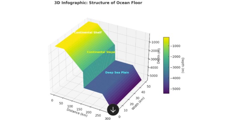
Submarine Geomorphology: How Is the Ocean Floor Shaped?
Submarine geomorphology examines the landforms of the ocean floor, which cover about 71% of Earth’s surface. Despite this large area, underwater landforms remain less studied due to access limitations.
In shallow marine environments, major features include:
- ripples and dunes
- sand waves and sand ridges
- submerged shorelines
- sub-surface channels
Along the continental slope, we find:
- submarine canyons
- gullies
- basin structures
- slump and slide scars
In deep ocean basins, significant landforms include:
- trench plains
- abyssal plains
- sediment wedges
- distributary channels
- submarine canyons
These underwater features help scientists understand past climates, sediment transport, sea-level changes, and plate tectonics.
Planetary Geomorphology: Can We Study Landforms on Other Planets?
Planetary geomorphology studies landforms on planets and moons with solid surfaces—such as Mars, Venus, and the moons of Jupiter and Saturn. It has grown rapidly with modern space missions.
Surface processes on other planets depend on:
- distance from the Sun
- rotational speed
- atmospheric composition
- surface temperature
Processes include weathering, aeolian activity, fluvial erosion, glacial flow, and mass movement, similar to Earth but influenced by each planet’s unique environment. The presence of dry river channels on Mars or volcanic plains on Venus are classic examples.
Climatic Geomorphology: Do Climatic Zones Create Distinct Landforms?
Climatic geomorphology—popular among French and German scholars—argues that each climatic zone (tropical, arid, temperate) develops a distinct set of landforms. For example, tropical regions may produce deep weathering profiles, while arid regions generate desert dunes and pediments.
Although climate strongly influences geomorphic processes, modern research suggests that landforms rarely depend on climate alone, because tectonics and long-term climate change complicate the picture. Still, this branch remains important for understanding environmental responses to climate variation
Source: Fundamentals of Geomorphology, Richard John Huggett
FAQs
1. What are some examples of landforms created by volcanic and tectonic geomorphology?
Volcanic geomorphology produces landforms like calderas, lava plateaus, shield volcanoes, cinder cones, and basaltic terraces.
Tectonic geomorphology produces fault scarps, rift valleys, block mountains, anticlines, and synclines. These landforms reflect internal forces of Earth such as folding, faulting, and magmatic activity.
2. Why is karst geomorphology considered unique?
Karst geomorphology is unique because it is created by the chemical weathering of soluble rocks like limestone, gypsum, and dolomite. It forms sinkholes, caves, dolines, lapies, stalactites, and stalagmites. Karst landscapes are important for studying groundwater movement, aquifer management, and land subsidence hazards.
3. How do periglacial processes contribute to geomorphic changes?
Periglacial geomorphology involves landform development in cold, non-glacial regions where freeze–thaw cycles dominate. These processes create patterned ground, solifluction lobes, block fields, ice wedges, and pingos. Periglacial landscapes are vital indicators of past climate change, making them important for both geography and environmental science exams.