


India has a very diversified physiographic condition. If we look at the distribution of physiographic units, then we will find that Mountains occupy 10.6 %, Hills occupy 18.5%, Plateaus occupy 27.7% and Plains occupy 43.2%.
Based on stratification and tectonic history, relief features in India can be divided into the following parts:
- The Himalayas
- The Great Plains
- The Central Highlands
- Peninsular Plateau
- The West Coast Plain
- The East Coast Plain
- The Islands
Here, we will discuss only the Northern and North-Eastern Mountains or The Himalayas
- The northern and northeastern mountain ranges include the Himalayas and the Purvachal hills.
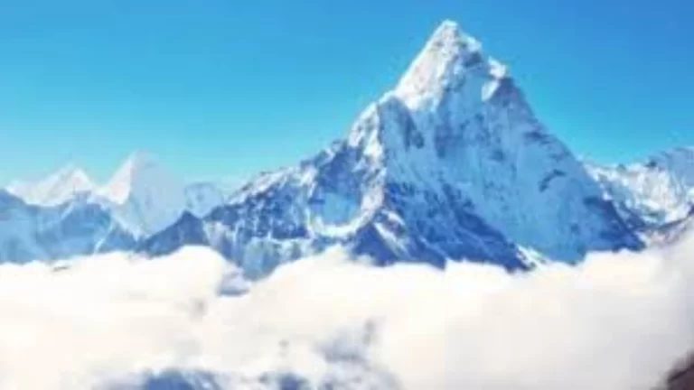
- It is the highest mountain range in the world, which is characterized by extensive accumulation of snow which is why it is known as Himavan (Abode of Snow), Himadri.
- The Himalayas stretch in the east-west and its length is 2400 km from the gorge of the Indus River in the west to the great gorge of the Brahmaputra River in the east.
- The width of the Himalayas is about 500 km in Kashmir and about 200 km in Arunachal Pradesh.
- It covers an area of 5 lacks sq. km.
- Its average altitude is 5,500 m.
- Most of the world’s highest peaks above 6,500 m are located in this region.
Geographical or Longitudinal Division of the Himalayas
The Himalayas are not a single mountain, but a group of many mountains ranges parallel to each other. From North to south, these are Trans-Himalaya, Greater Himalaya, Lesser Himalaya, and Shivalik.
Trans Himalaya
- It is also known as Tethys and Tibet Himalaya.
- Its width is about 40 km, and its length is about 965 km, which includes the Karakoram, Ladakh, and Kailash ranges.
- Its average altitude is found between 3100 m to 3700 m.
- This range acts as a water divide between the rivers that flow into the Bay of Bengal and the lakes of Tibet.
- There is a lack of vegetation cover over the entire range.
- The most important range across the Trans-Himalayas is the Karakoram, which is called the ‘Backbone of high Asia‘.
- It forms India’s international border with Afghanistan and China
- It consists of several highest peaks of more than 8000 m like K2 (8611 m), Hidden peak (8068 m), Broad peak (8047 m), and Gasher Bram II (8035 m), and large glaciers (Siachen 72 km of Nubra valley, Wyafo, and Baltaro 60 km of Shigar valley, Hispar and Hunza valley).
- Towards the west, the Karakoram range joins the Pamir-knot while towards the southeast it becomes the Kailash Range in Tibet.
- South of Karakoram lies the Ladakh range (altitude 5800 m) which acts as a water divide between the Indus and its tributary Shayok River.

Greater Himalaya
- It is also known as Himadri.
- It extends from the gorge of the Indus River in the west to the bend of the Brahmaputra River in the east.
- Its interior is made up of Archean rocks (granite, gneiss, schist) with metamorphic sedimentary rocks found in its flank.
- Most of the glacial peaks and ridges of the Himalayas lie in this range.
- Its average height is 6100 meters, but the height of many peaks is found more than 8000 meters such as Mount Everest (8848 m), Kangchenjunga (8598 m), Maikal (8481 m), Dhaulagiri (8172 m), Manasalu (8156 m), Nanga Mountain (8126 m) and Annapurna (8078 m).
- Important passes in this range are Burjil and Zojila of Kashmir, Bara Lacha La and Shipki La of Himachal Pradesh, Niti, Lipu Lekh of Uttarakhand, and Nathu La and Jelep La of Sikkim.
- Mount Everest is called ‘Queen of the Mountains’, in Tibetan. It is also known as Sagarmatha or Gaurishankar.
- The famous Kashmir valley is found between the Greater Himalaya and Pirpanjal ranges.
Lesser Himalaya or Himanchal Himalaya
- This range is situated to the north of Shivalik from which it is separated by the Main Boundary Thrust (MBT).
- Dhauladhar, Pirpanjal, Nag Tiba, Mahabharata, and Mussoorie ranges are notable ranges in this region.
- The Pir Panjal range of Kashmir is the longest and most important among these.
- Pir Panjal (3494 m) and Banihal (2832 m) are the main passes of this range.
- Most of the tourist destinations of the Himalayan region like Shimla, Ranikhet, Mussoorie, Nainital, Almora, Darjeeling, etc. are situated in this range.
- The southern slopes of the Lesser Himalayas are steep and undulating, while the northern slopes are gentle and covered with dense forests.
- Tropical and temperate evergreen forests (pine, deodar, blue pine, oak, magnolia) are found between an altitude of 1500 m to 2400.
- Pasture areas are found along the slopes, which are called Merg (eg, Gulmarg, Sonmarg, Tangmarg, etc.) in Kashmir and Bugyal and Payar in Uttarakhand.
Sub-Himalaya or Siwalik
- It is also called the outer Himalayas.
- It is the southernmost range of the Himalayas.
- The average height of this range is about 600 meters and 15 to 50 km wide.
- Most of the rivers descending from the northern ranges have cut through this range to form broad and steep sloping valleys. These River valleys are called ‘Doon‘ (dun) in the west and ‘Duar‘ in the east. Dehradun is an example of such type of valley (75 km x 20 km) which is filled with deposits of shale and clay.
- It is known by many local names such as Jammu Hills in Jammu and Kashmir, Dundwa Range in Uttarakhand, Churia Muria Hills in Nepal, Dafla, Miri, Abor, and Mishmi Hills in Arunachal Pradesh.
- The southern slopes of Shivalik are barren and highly eroded, which are called ‘Cho‘ in Himachal Pradesh.


Regional Division of the Himalayas
There are large-scale regional variations found in the Himalayas. Different scholars adopt their criteria to divide the Himalayas into regions. Some of the examples are as follows: –
Sir Sidney Burrard has divided the Himalayas into four transverse regions-
- Punjab Himalaya (500 km long between Indus and Sutlej rivers)
- Kumaon Himalaya (320 km long between Sutlej and Kali rivers)
- Nepal Himalaya (800 km long between Kali and Teesta rivers) and
- Assam Himalaya (720 km between Teesta and Brahmaputra rivers)
SP Chatterjee (1964) has divided it into the following regions
- Western Himalayas (Kashmir, Punjab, and Kumaon Himalayas
- Central Himalayas (Nepal Himalayas) and
- Eastern Himalayas (Purvachal or Northeastern Ranges)
R. L. Singh (1971) has divided the Himalayas into three sub-divisions –
- Western Himalaya: – (1) Kashmir Himalaya, and (2) Himachal Himalaya,
- Central Himalaya: – (3) Uttar Pradesh Himalaya, (4) Nepal Himalaya, and
- Eastern Himalaya
Based on relief, alignment of mountain ranges, and other geomorphic features, the Himalayas can be divided into many regions
- Kashmir Himalaya or North-West Himalaya,
- Himachal and Uttarakhand Himalaya,
- Darjeeling and Sikkim Himalaya,
- Arunachal Himalaya,
- Eastern Hills and Mountains,
- North-Western Branches of Himalayas.
Kashmir Himalayas or North-Western Himalaya
- It is also called Punjab Himalaya.
- The Punjab or Kashmir Himalaya extends from the Indus River to the Sutlej River.
- Four major mountain ranges are found in this part of the Himalayas. These are Karakoram, Ladakh, Zaskar and Pir Panjal.
- The northeastern part of the Kashmir Himalayas, located between the Greater Himalayas and the Karakoram ranges, is a cold desert.
- K2 or Godwin Austin (8611), Nanga Parbat (8126), Rakaposhi (7788), and Haramosh (7397) are some of the highest peaks of this region.
- Zojila in the Greater Himalayas, Banihal in the Pir Panjal range, Fotula in the Zaskar range, and Khardung La in the Ladakh range are important passes in this region.
- Here the Karakoram Pass, situated at an altitude of 5,575 m, acts as a gateway between India and the Tarim Basin.
- The important glaciers in the Karakoram range are – Valtoro, Siachen, Hispar, Batura, and Wiphao.
- The world-famous Kashmir Valley is also located between the Greater Himalayas and the Pir Panjal. Which is famous for Kareva. The Kareva Glacial Clay is a deposit of many types of glacial material. Kareva is suitable for Jafran cultivation.
- Indus and its two tributaries Jhelum and Chenab flow in this region.
- Kashmir and the North-Western Himalayas are famous all over the world for their unique beauty and beautiful scenery. Apart from tourists, many pilgrims also come here every year because famous pilgrimage sites like Vaishno Devi, Amarnath Cave, and Charar-e-Sharif are also located in the Kashmir Himalayas.
- Srinagar is situated on the banks of river Jhelum.
- Freshwater lakes – Dal and Wular and saltwater lakes Pangongtso and Tsomuriri are also found in this area.


The Himachal and Uttarakhand Himalayas
- It is also called Kumaon Himalaya.
- This part of the Himalayas extends between the Sutlej River in the west and the Kali River, a tributary of the Ghaghra, in the east.
- It lies in the state of Himachal Pradesh, and Uttarakhand.
- This region is drained by two major river systems of India – the Indus and the Ganga. The tributaries of the Indus – Ravi, Beas, and Sutlej and the tributaries of the Ganges – Yamuna and Ghaghra flow in this region.
- All three main mountain ranges of the Himalayas – the Greater Himalayas, the Lesser or Middle Himalayas, and the vast Shivalik range are located in this section.
- The Lesser Himalayas are called Dhauladhar in Himachal Pradesh and Nagbhita in Uttarakhand.
- Most of the hill stations like Dharamsala, Mussoorie, Shimla, and Kasauli and health centers like Ranikhet and Landsdown are situated here.
- Many longitudinal valleys (Doors) are also found in the southern part of this part of the Himalayas, among which the notable ones are Dehradun, Kothridoon, Patlidoon, Chandigarh-Kalka Ka Doon, Nalagarh Dun, Harike Dun, and Kotadoon, etc.
- The Kumaon and Garhwal hills of the Greater Himalayas are populated by the Bhotia race. These people live at an altitude of about 3200 to 4100 meters and they are nomadic people who migrate to Bugyal (the grasslands near the snow line) in summer with their animals like sheep, goats, porcupines, mules, donkeys, etc., and return to the valleys in winter.
- The Bhagirathi (Ganges), Alaknanda and Yamuna rivers have their origins here.
- Some of the important peaks like Nanda Devi, Badrinath, Kedarnath, Kamat, Trishul, and Hemkund Sahib are found in this part of the Himalayas.
Darjeeling and Sikkim Himalayas
- It is also called Nepal Himalaya or Central Himalaya.
- Small but important part of the Himalayas, which spread over a length of about 800 km between the Kali River and the Teesta River.
- The highest peaks of the Himalayas as Mount Everest (on the Indo-Nepal border), Kanchenjunga, Dhaulagiri, Makalu, and Annapurna, etc. are located here.
- The Lepcha tribes are found in the higher parts of these mountains and mixed population in their southern parts which include Nepali, Bengali, and Central Indian tribes.
- Sikkim and Darjeeling are famous for the Himalayan Fauna, Flora, Scenic Beauty, and Colourful Orchids.

Arunachal Himalayas
- It is known as the Assam Himalayas.
- The Arunachal Himalayas extend from the Bhutan Himalayas to the Diphu Pass in the east.
- The height of the Himalayas starts decreasing here again. The main peaks of this region are Kula Kangri, Namcha Barwa, Kangto, Chomolhari, etc.
- The fast-flowing rivers from north to south have created deep gorges in this part of the Himalayas. The Brahmaputra after crossing Namcha Barwa forms a great gorge.
- Many tribes live in this part of the Himalayas. From west to east, these tribes are Monpa, Dafla, Abor, Mishmi, Nishi, and Naga. These tribes do Jhum cultivation (shifting agriculture). It called as ‘Slash and Burn‘ farming.
Eastern Hills and Mountains
- Situated to the east of the Brahmaputra River in the north-south direction.
- Known by many local names such as Patkai, Bum, Naga Hills, and Manipur Hills in the north, Mizo or Lushai, Arakan Hills in the south.
- These hills form the international border between India and Myanmar.
- There is a famous lake situated in the middle of Manipur valley which is called Loktak Lake. It is surrounded by hills from all sides.
- Mizoram, known as the ‘Molasses Basin‘, is made up of soft and unorganized rocks.
- Barak is the main river of Manipur and Mizoram. The Barak itself is a tributary of the Meghna River.
- Most of the rivers flowing into Nagaland are tributaries of the Brahmaputra River.
- The rivers flowing in the eastern part of Manipur are tributaries of the Chindwin River. The Chindwin River itself is a tributary of the Irrawaddy River flowing in Myanmar.
North-Western branches of the Himalayas
- Beyond the gorge of the Indus River, these branches of the Himalayas diverge in the northwest direction. These include Hazara, Sulaiman, Bugti, Kirthar, etc.


