


Estimated reading time: 4 minutes
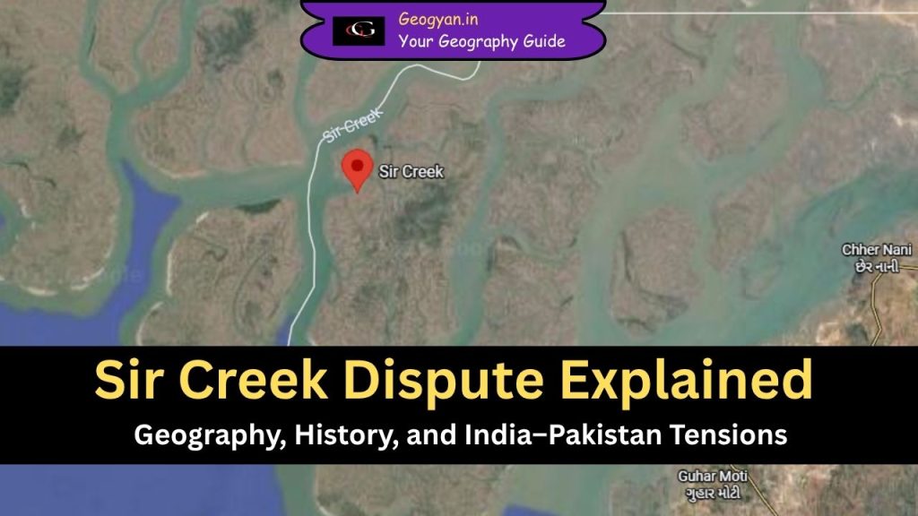
Table of contents
Why is Sir Creek in the News?
Recent news about Sir Creek highlights renewed tensions between India and Pakistan following a significant military build-up by Pakistan near this disputed maritime boundary in the Rann of Kutch region. In early October 2025, India’s Defence Minister Rajnath Singh issued a stern warning that any hostile action or misadventure by Pakistan in the Sir Creek sector would provoke a decisive response from India, underscoring the region’s strategic importance for security, resource access, and border stability.
The increased military presence, coupled with the creek’s value for fishing, potential oil and gas reserves, and its impact on the delimitation of both countries’ Exclusive Economic Zones in the Arabian Sea, has brought Sir Creek back into the spotlight as a potential flashpoint in India-Pakistan relations.
What Is Sir Creek?
Sir Creek is a 98-km-long tidal estuary located in the Rann of Kutch, lying between the state of Gujarat (India) and Sindh province (Pakistan). It connects to the Arabian Sea and plays a crucial role in defining the India–Pakistan maritime boundary.
Geographically, it is part of the Indus River Delta system, consisting of several creeks formed by tidal action. The region is ecologically sensitive, known for mangroves, salt marshes, and rich marine biodiversity.
Why Is Sir Creek Disputed?
The Sir Creek dispute dates back to the pre-independence period, arising from different interpretations of a 1914 agreement between the Government of Bombay and the ruler of Kutch.
- India’s Claim:
India believes the mid-channel line (Thalweg principle) should be the boundary — meaning the line running through the deepest part of the navigable channel divides the creek. - Pakistan’s Claim:
Pakistan argues that the eastern bank of the creek should mark the boundary, thus giving it control over more territory and exclusive fishing rights.
This disagreement affects about 100 square miles of marshy land and maritime boundary extension, which impacts the EEZ and continental shelf claims under UNCLOS (United Nations Convention on the Law of the Sea).
Geographical Significance of Sir Creek
| Feature | Description |
| Location | Western India, bordering Gujarat’s Kutch and Pakistan’s Sindh province |
| Length | 98 km tidal estuary |
| Type | Brackish water creek formed by tidal currents |
| Delta System | Part of the Indus Delta |
| Vegetation | Mangroves and salt-tolerant species |
| Economic Value | Rich in marine life; major fishing area |
| Strategic Importance | Vital for naval surveillance and maritime border security |
The Sir Creek area also forms a natural barrier between the two nations and holds significance for defense and coastal ecology.
What Are the Key Issues in the Sir Creek Dispute?
- Boundary Alignment: Different interpretations of the 1914 map and texts.
- Tidal Changes: The course of the creek shifts naturally due to silt and tides.
- Maritime Extension: Impacts EEZ claims extending up to 200 nautical miles.
- Security Concerns: Frequent arrests of fishermen due to unclear boundaries.
- Environmental Impact: Loss of mangroves and marine pollution affecting biodiversity.
Sir Creek and India’s Maritime Geography
From a geographical perspective, Sir Creek is an important estuarine ecosystem.
It represents the interaction zone of land, sea, and riverine processes, showcasing:
- Deltaic formation of the Indus system.
- Tidal sedimentation patterns and coastal geomorphology.
- Influence of Arabian Sea monsoon cycles on creek dynamics.
Such features make it a valuable case study for geography students studying coastal geomorphology, deltaic evolution, and boundary demarcation.
How Does UNCLOS Affect the Sir Creek Issue?
Under UNCLOS (1982), the determination of territorial waters, contiguous zones, and EEZ depends on the coastal baseline.
Hence, the location of Sir Creek’s boundary directly influences how far each nation can extend its maritime rights.
A resolution would help define:
- The baseline for territorial waters.
- The EEZ boundary (up to 200 nautical miles).
- The continental shelf extension for undersea resource exploration.
Sources: DDN
FAQs
Q1. Where is Sir Creek located?
Sir Creek lies in the Rann of Kutch, forming the border between India’s Gujarat and Pakistan’s Sindh province.
Q2. Why is Sir Creek important geographically?
It is part of the Indus Delta, rich in mangroves and fisheries, and influences the Arabian Sea coastal ecosystem.
Q3. What is the main reason for the Sir Creek dispute?
The dispute arises from different interpretations of the 1914 Bombay-Kutch agreement, determining which side owns the creek.
Q4. Which international law governs the Sir Creek issue?
The United Nations Convention on the Law of the Sea (UNCLOS) helps define maritime boundaries and EEZs.


