Advanced Radar Applications: Exploring Stereo Imaging, Interferometry, and Polarimetry
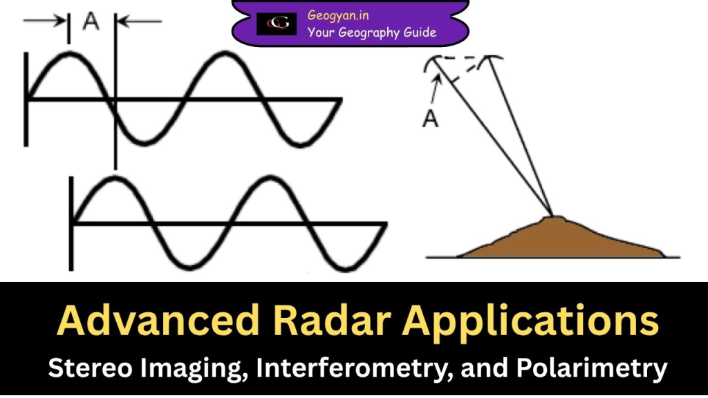
Radar technology has evolved significantly, allowing scientists and researchers to map terrains, measure elevations, and analyze surface features with high precision. Advanced radar applications like Stereo Radar Imaging, Interferometric Radar (Interferometry), and Radar Polarimetry are used in various fields, including forestry, geology, disaster management, and urban planning. In this article, we will explore these applications, […]
Radar Image Properties
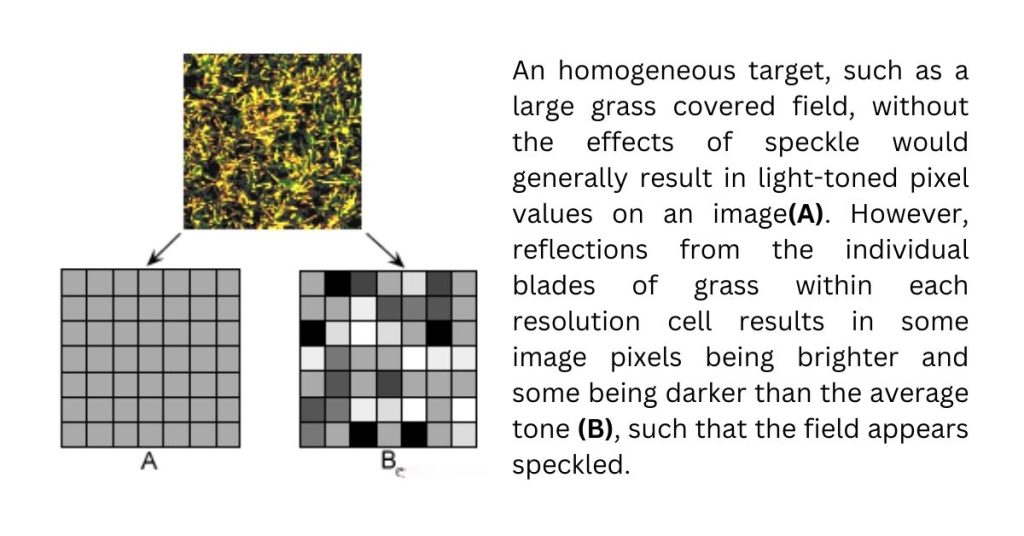
Radar imaging is crucial for remote sensing but comes with unique properties like speckle and slant-range distortion. This article explains these properties and how techniques such as multi-look processing and spatial filtering are used to improve image clarity and accuracy. Learn about radiometric resolution and calibration for effective radar data analysis in various applications.
NISAR Satellite: NASA–ISRO Mission, Features, and Geography Insights
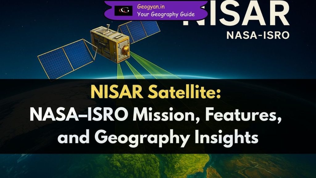
Discover everything about the NISAR Satellite, a joint NASA-ISRO mission set to launch in 2025. Learn about its features, geographical applications, importance for disaster management, and role in climate change research. Perfect for UPSC, IAS, and geography students. Stay updated with the latest facts on Earth’s most advanced radar imaging satellite.
Radar Image Brightness: How Surface and Environmental Factors Affect Image Appearance

Discover how surface roughness, viewing angle, moisture content, and structural geometry influence radar image brightness. Learn how these factors help interpret radar images for applications in agriculture, urban planning, disaster management, and environmental monitoring.
Viewing Geometry and Spatial Resolution in Radar Imaging

Learn about viewing geometry and spatial resolution in radar imaging. Understand range, azimuth, SAR, and how these factors impact image quality in remote sensing applications.
Radar Basics: How Radar Works

Explore how radar works, from transmitting radio waves to interpreting reflected signals. Discover the different radar frequency bands (X-band, C-band, etc.) and their applications in various fields.
Microwave Remote Sensing: Types, Applications, and Importance

In our daily lives, microwave remote sensing technology is used in weather forecasting, satellite-based navigation, and even in microwaves for cooking food. This article explores the two types of microwave sensing—passive and active—along with their applications and significance.
Data Reception, Transmission, and Processing in Remote Sensing

Remote sensing technology helps us collect data from the Earth’s surface using aircraft and satellites. This technology is widely used in environmental monitoring, disaster management, urban planning, and scientific research. However, the data collected needs to undergo data reception, transmission, and processing in remote sensing before it can be analyzed and used effectively. Let’s explore how this process works in a detailed and simple way.
Marine Observation Satellites and Sensors: SeaWiFS, Nimbus-7, and MOS-1

Marine observation satellites (SeaWiFS, Nimbus-7, MOS-1) are key to tracking ocean health. Learn about their role in climate change, pollution monitoring, and disaster prevention. Understand the tech protecting our seas.
Earth Observation Satellites: Landsat, SPOT, and IRS

Uncover the history and impact of Earth Observation Satellites, essential for detailed monitoring of the Earth’s surface and resources.
Weather Satellites: GOES, NOAA AVHRR, and More
Weather monitoring and forecasting were among the first civilian uses of satellite remote sensing. This began with TIROS-1 (Television and Infrared Observation Satellite – 1), the first true weather satellite, launched by the United States in 1960. Over the next five years, more weather satellites were sent into space, following near-polar orbits. These satellites provided repeated observations of weather patterns across the globe.
Geometric Distortion in Satellite Imagery: Causes and Corrections

When we look at satellite or aerial images, we often assume they are accurate representations of the Earth’s surface. However, these images frequently contain geometric distortions—errors that make objects appear stretched, compressed, or misaligned.
Thermal Imaging: Seeing the Invisible with Heat Sensors

Have you ever wondered how firefighters detect people in a smoke-filled building or how satellites measure the temperature of the Earth’s surface? The answer lies in thermal imaging, a remote sensing technique that captures heat instead of visible light.
Multispectral Scanning: A Game-Changer in Remote Sensing

Have you ever wondered how satellites can track deforestation, monitor crop health, or even predict weather patterns? The secret lies in multispectral scanning, a remote sensing technology that captures detailed images of the Earth’s surface across multiple wavelengths.
Aerial Photography: Techniques, Types, and Applications

Aerial photography is one of the oldest and simplest methods used in remote sensing to capture images of the Earth’s surface. Think of it like using your smartphone camera but on a much larger scale, from aircraft or satellites, to take pictures of land, cities, forests, or farmlands. These images help in mapping, environmental studies, disaster management, urban planning, and many other fields.